Hurricane Milton, which recently lashed out the western coast of Florida, made landfall as a powerful category 3 storm. It caused heavy rain and strong winds, causing flooding and severe damage to homes and entire neighborhoods.
According to a NY Post report, experts had warned that Milton could change Florida’s shape. They predicted that around 95% of Sunshine State beaches would be flooded by water in the storm.
The report also stated that the US Geological Survey warned this is the most severe level of coastal change and that Milton’s waves and surges could lead to erosion and overwash to 100% of the state’s beaches.
Take a look at how Milton changed Florida geographically with these satellite images.
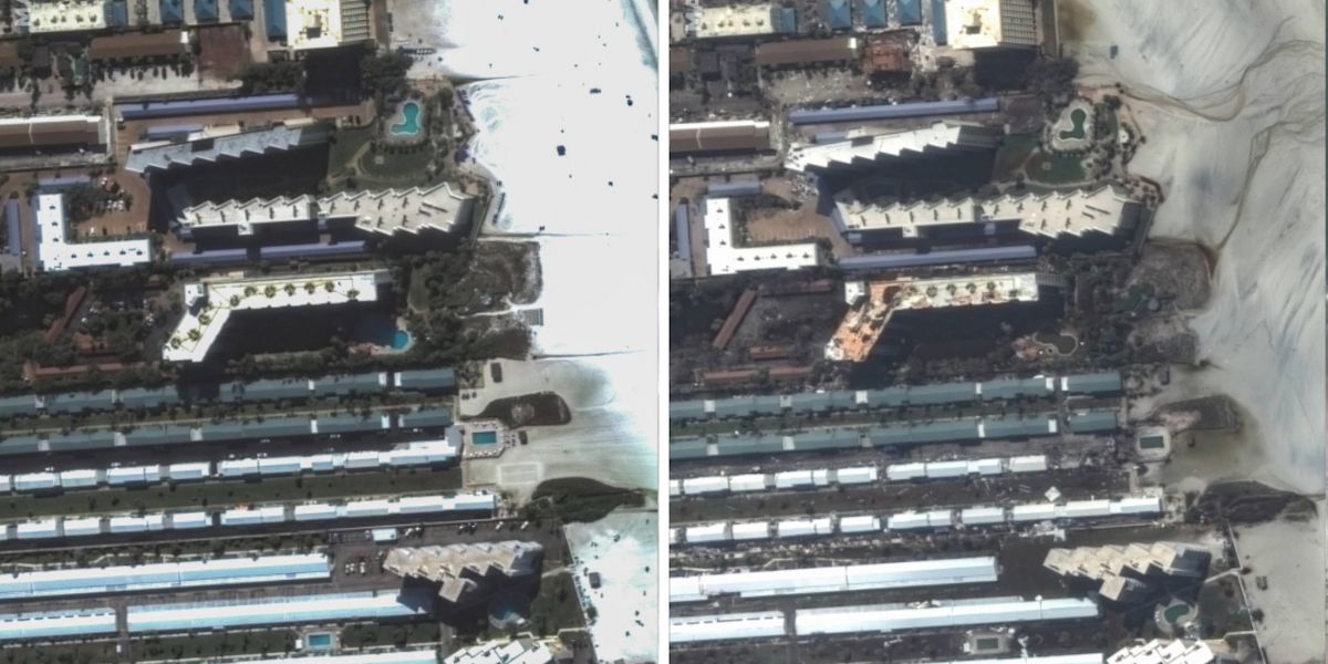
1. Satellite Images Of Siesta Key Before And After Hurricane Milton
These images were taken a day after the storm hit Siesta Key beaches and Anna Maria Island, which looked dark and damaged. The murky sand seemed to have moved inland, reaching the nearby streets and buildings. The left side satellite image taken of the same areas before the storm. This region has been facing challenges as it dealt with the aftermath of two hurricanes stuck in quick succession- Hurricane Helene struck the place less than two weeks before Milton.
These before and after satellite pictures depict the impact of Hurricane Milton, highlighting the significant damage caused to buildings and roofs in Siesta Key after the storm on October 10, 2024.
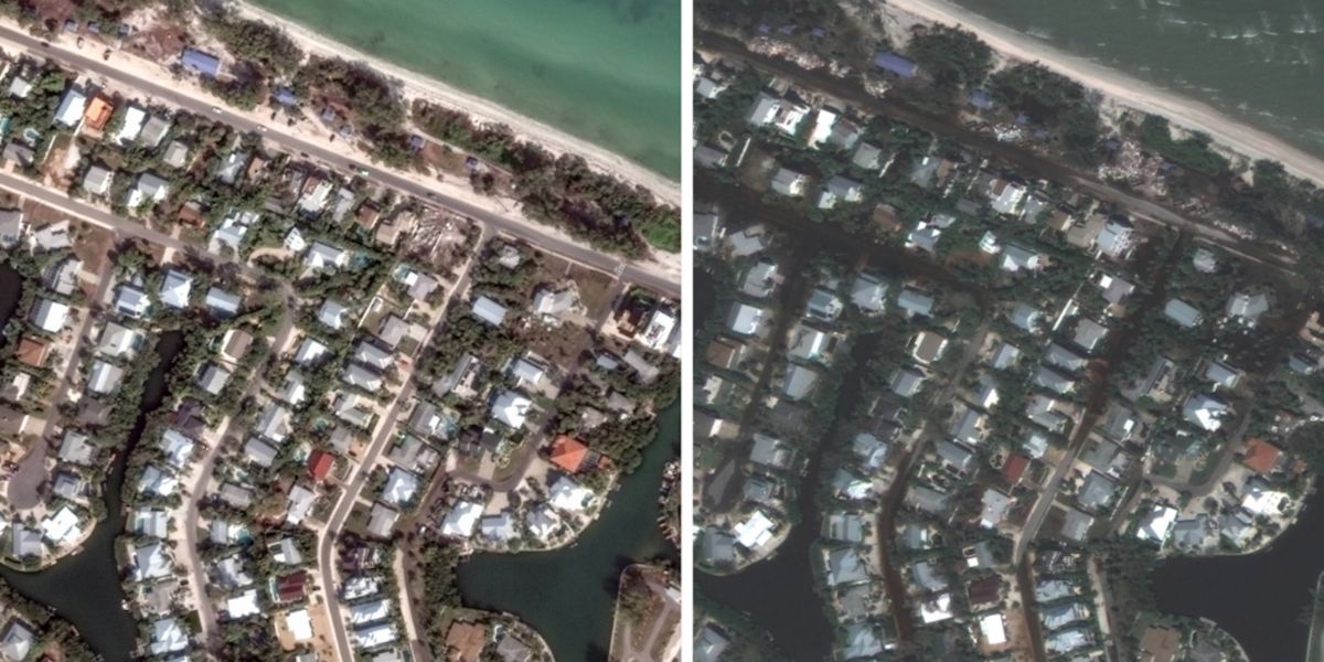
2. Satellite Images Of Anna Maria Island Before And After Hurricane Milton
These satellite images were taken before and after Hurricane Milton passed through Anna Maria Island. It shows flooded streets and storm debris scattered across the area.
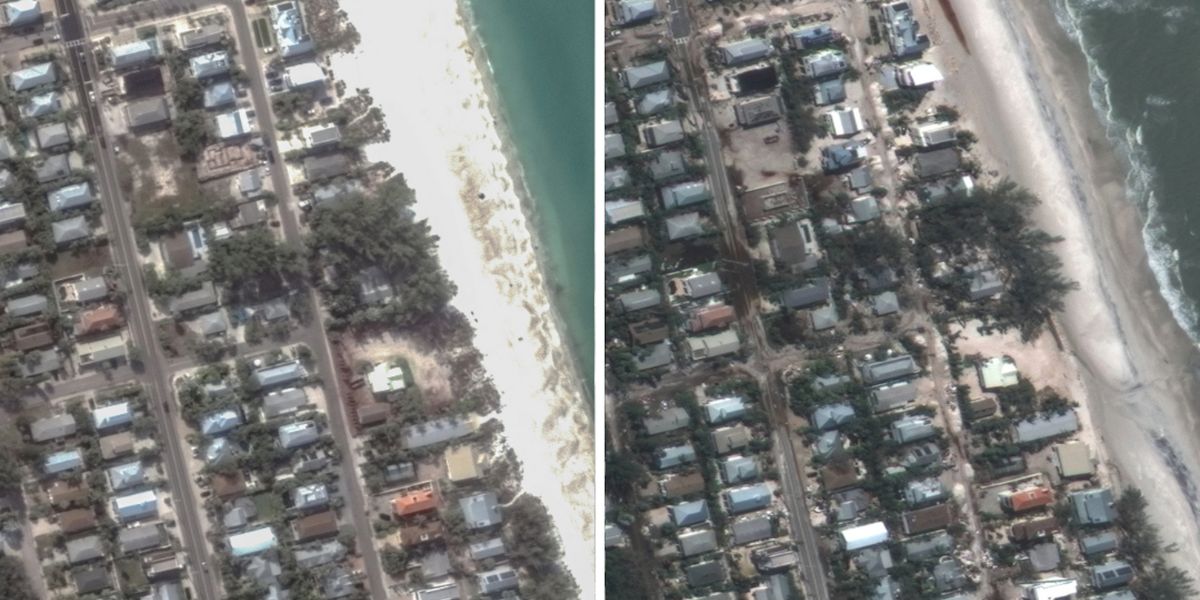
3. Satellite Images Of Holmes Beach On Anna Maria Island Before And After Hurricane Milton
Another satellite image taken before and after Milton in Holmes Beach on Anna Maria Island shows the streets covered in sand and water.
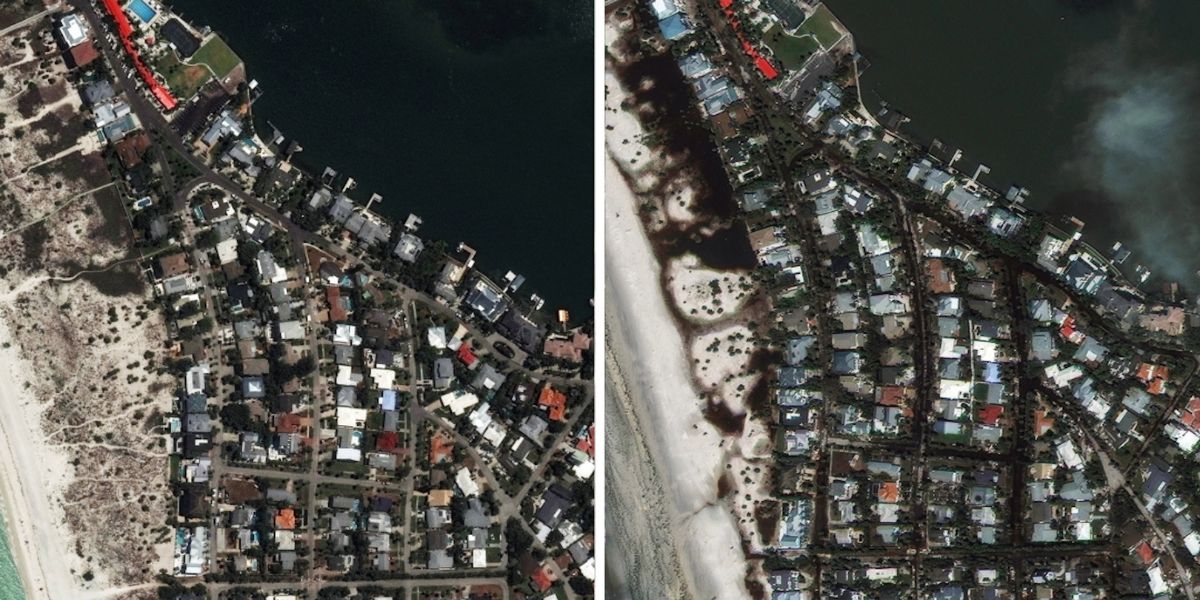
4. Satellite Images Of Clearwater Before and After Hurricane Milton
Another satellite image taken in Clearwater, near Tampa and St. Petersburg shows destruction. The left side satellite image was taken at the same place before Milton. High-water vehicles and boats were used by the first responders to rescue families, who were trapped inside a local apartment complex.
Some homes in the nearby Tampa area were almost completely submerged after the storm. Rescues were conducted by the Hillsborough County Sheriff’s Office, evacuating over 135 residents from an assisted living facility.
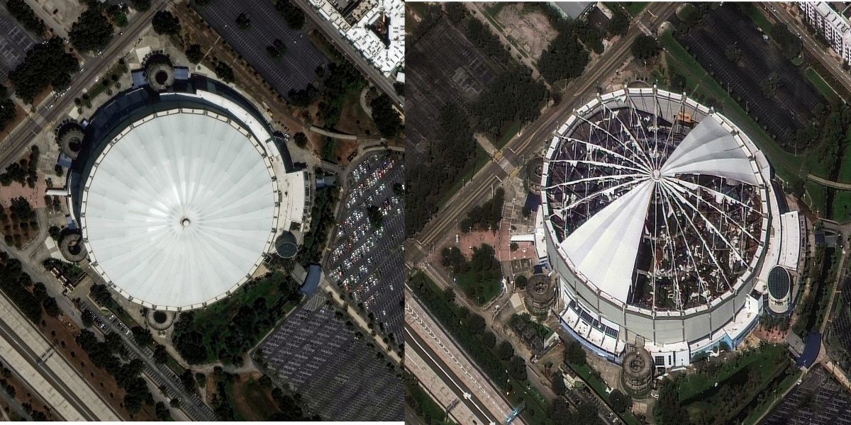
5. Satellite Images Of Tropicana Field Before and After Hurricane Milton
The devastation caused by the storm can be seen clearly in this picture of the Tropicana Field, the Tampa Bay Rays’ home stadium, in St. Petersburg, Florida. The stadium, which used to be a staging area for first responders, was damaged by strong winds that ripped apart its fabric roof. The large gaps were formed after the fabric roof of the domed building was ripped off. Although the damage inside the stadium was not known, the debris was visible on the field.
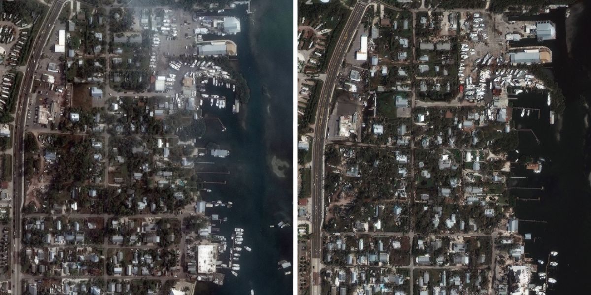
6. Satellite Images Of Cortez Before And After Hurricane Milton
Both Helene and Milton damaged the historic fishing village in Cortez, located along the coast in Sarasota County- trees were knocked down, power lines were destroyed and buildings were reduced to piles of rubble. In the satellite image, you can see the roads and the docks that line the waterfront were covered with debris.
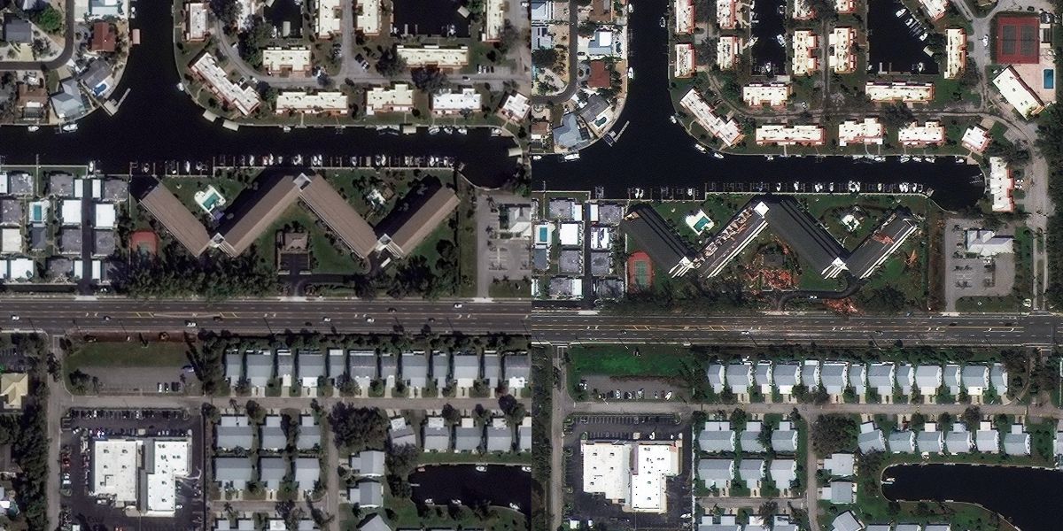
7. Satellite Images Of the Waterway Condominium Association Building In Cortez Before And After Hurricane Milton
These are the pictures of the Waterway Condominium Association building in Cortez, Florida- the before and after satellite pictures. The after-Milton photo (bottom) shows the extent of damage- a portion of the building’s roof was ripped off with debris scattered on the ground.
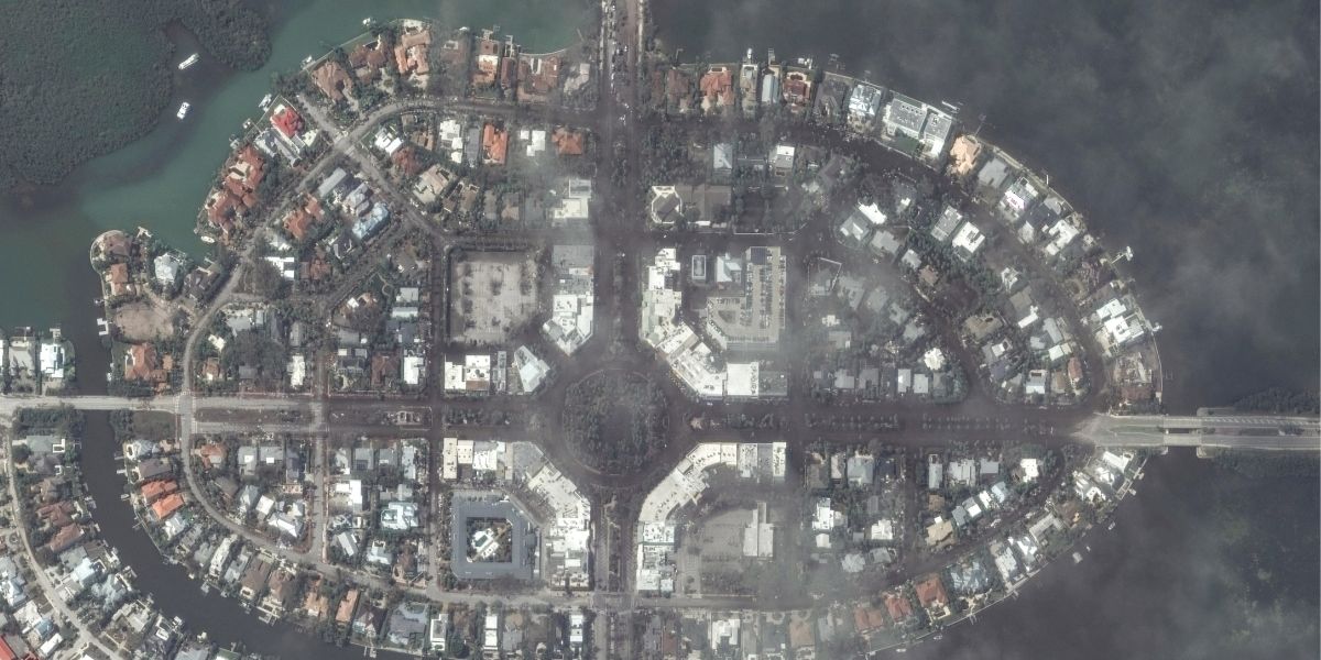
8. Satellite Images Of St. Armands Key In Sarasota Before and After Hurricane Milton
Hurricane Milton wreaked havoc in St. Armands Key, a barrier island near Sarasota. This satellite image shows the aftermath of the storm, revealing that the streets in the area were completely flooded with water.
9. Hurricane Milton Cutting Iconic Beaches In Half
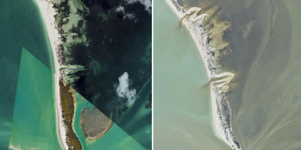
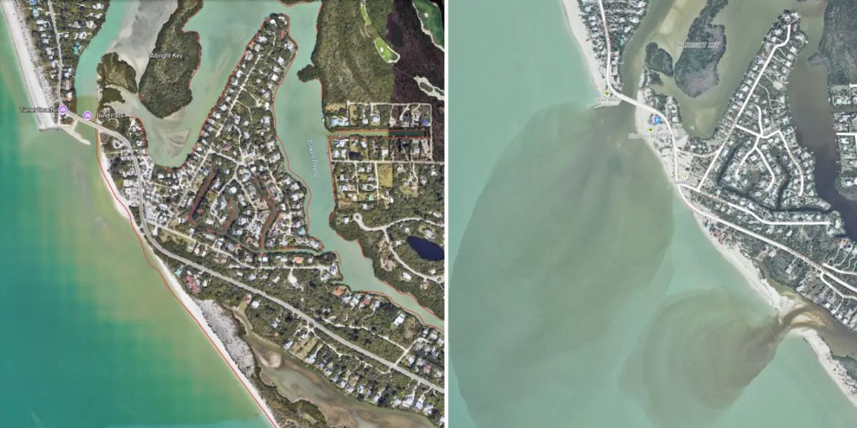
The Florida coastline was reshaped because of a deadly storm, splitting some parts of iconic beaches in half. The coastlines of Sanibel and Captiva Islands, located just off the coast of Cape Coral, were significantly changed due to the destruction caused by Milton. The satellite picture of Sanibel Island shows brown and white plumes along the coastline, which are sand, dirt and sediment redeposited back into the gulf. According to Fox Forecast Center meteorologist Cody Braud, these brownish hues are normal and are the result of the movement of large amounts of dirt.
In this satellite picture (right), multiple white and brown plumes can be seen along the coastline of North Captiva Island.
10. Satellite Images Of Sanibel Island Before and After Hurricane Milton
These satellite images show before and after scenes of Hurricane Milton. The after-picture shows plumes of brown and white along the coastline of Sanibel Island.
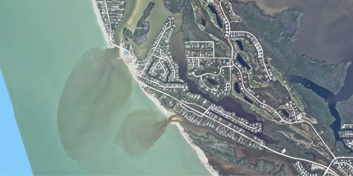
11. Brown Plumes Visible In Satellite Image
The satellite image shows brown plumes, which are actually dirt that was brought out into the gulf after the storm.
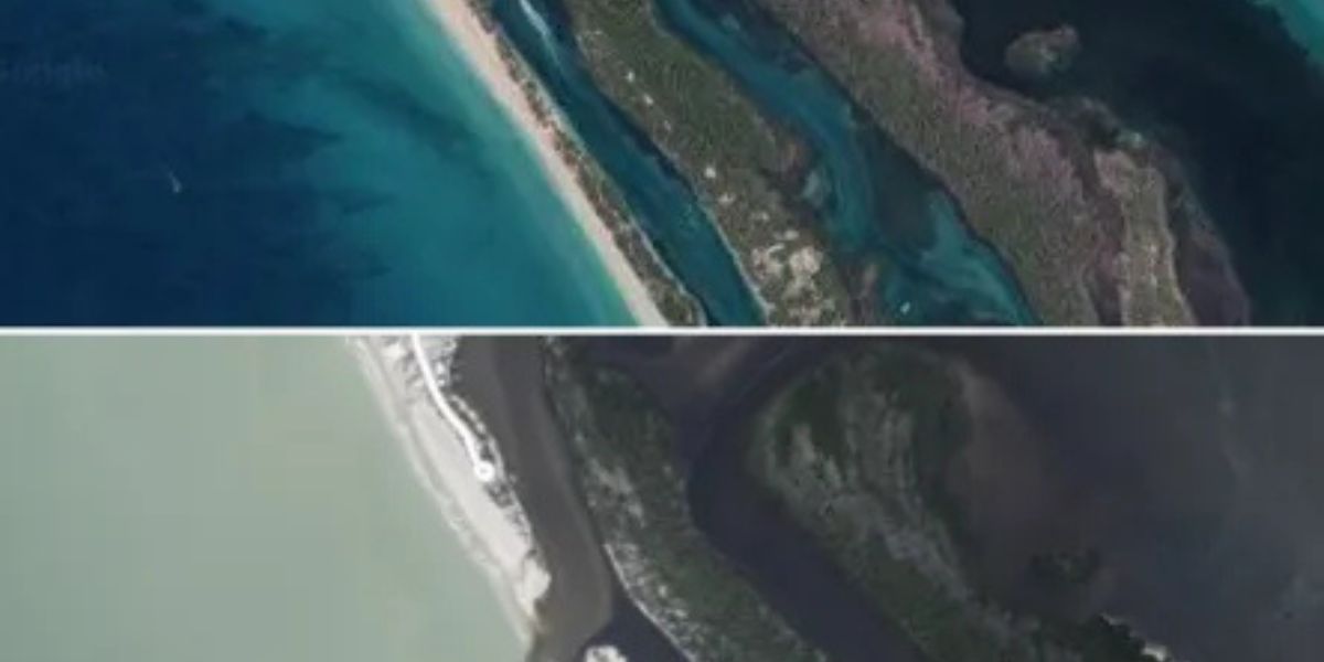
12. Satellite Images Of Stump Pass Beach Before and After Hurricane Milton
Images also show the splits in some of Florida’s popular beaches caused by the water rushing back into the Gulf after the storms. As the water flows out, it could create new channels in order to return to the oceans. The above image shows Stump Pass Beach’s appearance before and after Hurricane Milton hit the area.

